I needed lat/long of each pixel of a GeoTiff file. I searched through internet to find a solution and ,thanks to Stack Overflow, found a piece of code that I modified. As usual, python and gdal were used. Just follow the instructions below.
First get the number of rows and columns of you image by using gdalinfo (although it can be automated as well but lets just go with it)
gdalinfo raster.tif
Now edit the python code below and set rows and columns according to your image (don’t forget to change the image name).
from osgeo import gdal

# Open tif file
ds = gdal.Open('raster.tif')

# GDAL affine transform parameters, According to gdal documentation xoff/yoff are image left corner, a/e are pixel wight/height and b/d is rotation and is zero if image is north up.
xoff, a, b, yoff, d, e = ds.GetGeoTransform()

def pixel2coord(x, y):
 """Returns global coordinates from pixel x, y coords"""
 xp = a * x + b * y + xoff
 yp = d * x + e * y + yoff
 return(xp, yp)

# get columns and rows of your image from gdalinfo
rows = 36+1
colms = 34+1

if __name__ == "__main__":
 for row in  range(0,rows):
  for col in  range(0,colms):
   print pixel2coord(col,row)
Finally, execute this python script using following command (provided that you have named your file script.py)
python script.py
Here is the output of my raster.tif
(29.25, 6.0)
(29.5, 6.0)
(29.75, 6.0)
(30.0, 6.0)
(30.25, 6.0)
(30.5, 6.0)
(30.75, 6.0)
(31.0, 6.0)
(31.25, 6.0)
(31.5, 6.0)
.
.
.
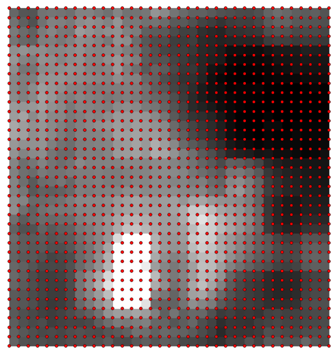
In my case, I converted output to csv and opened it in qGIS along with raster.tif (shown below).
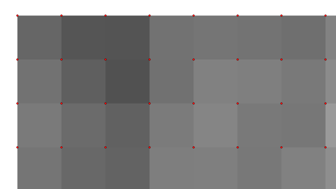
and a closer look


Thank you lot…………
You are welcome
File “coordinates-raster.py”, line 9
def pixel2coord(x, y):
^
IndentationError: unexpected indent
Thanks for the correction
How to convert output to csv in spyder?
Please respond.Urgent issue
Thanks.
Modify the following code
# csv library
library csv
# writer for csv
csvfile = open(‘/home/geoinformatics/myscripts/py/csv/sequence_fmnr.csv’, ‘wb’)
csv_writer = csv.writer(csvfile, delimiter=’,’,quotechar=’|’, quoting=csv.QUOTE_MINIMAL)
#now in the final loop use the writer instead of print command
csv_writer.writerow(str_temp)
Thanks for the response. Your code works.
We get points of leftmost corner. Can i get Lat/Long for centre of pixels(centroid). Do you know any way in python if that can be done?
Thanks.
Sorry, I never looked at pixel’s center coordinates, thus, I don’t have a script for that.
Thank you. I got the centre coordinates by modifying the code. The code works awesome on Sentinel 2A pixels.
But the code doesnt work out on Landsat pixels. In one pixel in Landsat i am getting many number of points through the code.
Can you advise on this. Thanks
you are welcome, can you post an example of landsat images
Nice article. Thank You.
Had a question here :
How can I get inverse of this.
def pixel2coord(x, y):
“””Returns global coordinates from pixel x, y coords”””
xp = a * x + b * y + xoff
yp = d * x + e * y + yoff
return(xp, yp)
like from global coordinates to pixel ?
You are welcome and thanks. About your question, do you mean from Latitude and Longitude to pixel x y?
Hi, This is really helpful. I’m relatively new to working with rasters in Python. Can you point me to some instruction about how to find rows and column with gdalinfo? Having trouble with this step. Thank you!
Thanks.
first you need to install gdal. Then goto the folder where your raster is (or provide the path in the gdalinfo command). The output will have a section called “Size is” and that is the size of your raster (in terms of pixels) first value is column and the second is rows.
Hi, how to convert Latitude and Longitude to pixel x y?
Hi
What do you need, pixel value or pixel number?
How to convert longitude and lattitude into pixels?
Hi
What do you need, pixel value or pixel number?
Hi,
I’m very new to python and am using a jupyter notebook. I’m getting this error:
NameError Traceback (most recent call last)
in ()
2
3 “””Returns global coordinates from pixel x, y coords”””
—-> 4 xp = a * x + b * b + xoff
5 yp = d * e + y * b + yoff
6 return(xp, yp)
NameError: name ‘x’ is not defined
Hi,Why I got only one latitude and longtitude repeatedly for all pixel